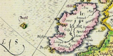







Stories about the island have circulated throughout Europe for centuries. It is said that the island is home to saints or a paradise with an advanced civilization.
Hy-Brasil is a mysterious island that appeared on maps from 1325 to the 1800s; the ghost island of Hy-Brasil is located somewhere in the Atlantic Ocean west of Ireland.
Folklore from many parts of the world tells of numerous strange and mysterious places around us. One such place is an island off the west coast of Ireland, shrouded in thick fog and only visible once every seven years.
Irish oral traditions tell of the island being a foggy island that disappears when people approach. These stories later appeared in printed Irish folklore, and you certainly won’t know which one to read first as they are all fascinating. According to Dr. McAnally’s 1888 book, *Irish Wonders*, the floating island was sighted by residents of County Cork on July 7, 1878.
The number seven has appeared three times, and this is highly symbolic as the number seven is considered a spiritual number indicating a strong spiritual presence behind the matter. It can also indicate encoded information, as in alchemical texts. In any case, its unusual appearance has been described in The Irish Miracles as follows:
“On Sunday afternoon, July 7, 1878, the residents of Ballycotton in County Cork were greatly excited by the sudden appearance of a distant island offshore whose existence was unknown. The men of the town and island of Ballycotton were fishermen and were all too familiar with the sea as well as the land. The day before, they had sailed and headed toward where the strange island now appeared, and they were certain it was the best fishing ground they had.”
However, they looked further, and their surprise grew, for the day was clear, and the island was as clearly visible as the hills to the north. In some places it was rugged, in others densely forested. At one end it rose almost steeply above sea level, at the other it sloped gently.”
On most maps, the island is located 321 km (approximately 200 miles) off the west coast of Ireland in the Arctic Ocean. One of Hy-Brasil’s distinctive geographical features on maps is that it often appears as a curved line with a channel (or river) running from east to west.
Expeditions to find Hy-Brasil
Hy-Brasil Island has several different names; it may be called Bracile or Illa de brasil . In 1436, a cartographer named Andrea Bianco depicted it on a map under the name Sola de Brasil .
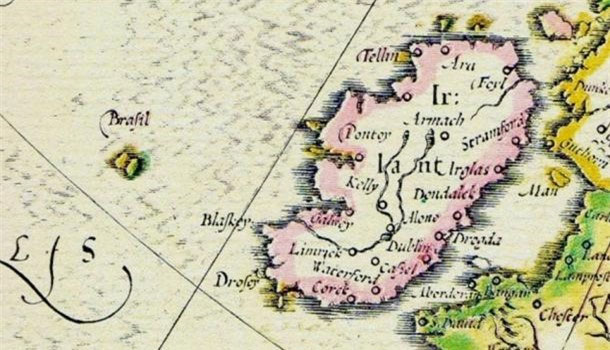
Hy-Brasil Island has many different names.
Historically, numerous expeditions have been undertaken to find this mysterious island. In 1480, John Jay Jr. from Bristol, England, made a two-month voyage without success. In 1481, two more ships, the Trinity and the George, set sail from Bristol to search for Hy-Brasil, but were also unsuccessful.
However, in 1497, a Spanish diplomat named Pedro de Ayala reported to the Spanish king that someone had once discovered the island. Nearly two centuries later, a Scottish captain named John Nisbet claimed to have found Hy-Brasil during a voyage from France to Ireland in 1674. It is rumored that he sent four crew members ashore, and they spent the day on the island.
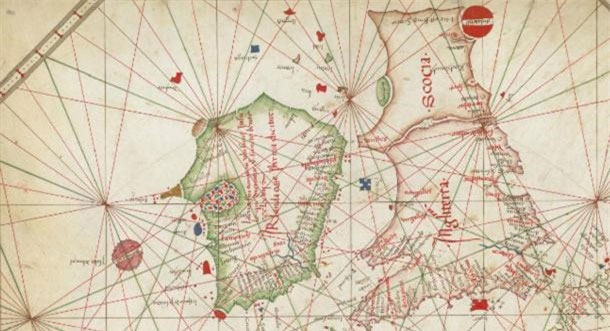
A nautical chart from 1473 depicts the island in a circular shape.
According to Captain John Nisbet’s account, his sailors met a wise old man who gave them gold and silver. Even stranger, the island was home to a large black rabbit and a mysterious sorcerer who lived alone in a stone castle. Following Nisbet’s story, another captain, Alexander Johnson, also claimed to have found Hy-Brasil, corroborating Nisbet’s findings.
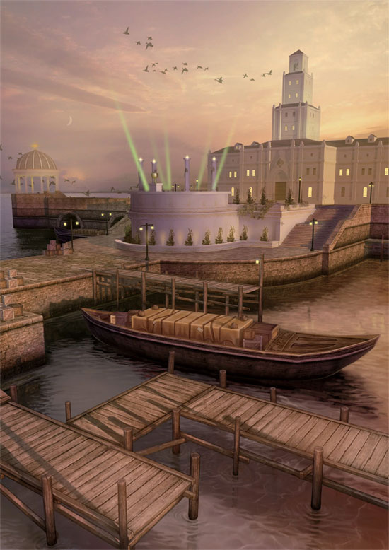
Many people imagine Hy-Brasil to look like this.
In the years that followed, efforts to find Hy-Brasil proved unsuccessful, and the island was gradually removed from maps. The place last appeared on a map drawn in 1865, simply labeled as the Brazilian Rocks. In 1872, two locals, Robert O’Flaherty and T.J. Westropp, claimed to have seen the island three times, bringing their families to witness it firsthand. The island vanished into thin air right before their eyes.
Legend of the island of Hy-Brasil
There are many legends and myths surrounding Hy-Brasil. Some say the island is home to the gods of Irish folklore. Others claim it was the dwelling place of monks who possessed ancient knowledge that allowed for the development of advanced civilizations. Still others believe that St. Brendan’s famous voyage in search of the “Promised Land” actually took place on Hy-Brasil.
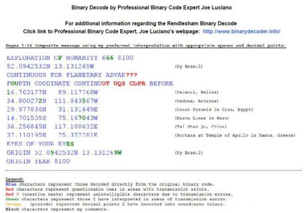
The binary code table shows the coordinates of Hy-Brasil and several other landmarks.
In the famous UFO encounter, often referred to as the Rendlesham Forest incident , a strange vessel allegedly landed outside a US military base, and soldier Jim Penniston claimed to have touched the vessel and received 16 pages of binary code telepathically. The next day, he wrote down the entire sequence of code on paper, and it was then deciphered. This sequence listed in considerable detail the coordinates of Hy-Brasil and the locations that ancient cartographers had drawn on maps. It also mentioned several other structures such as the Giza pyramids and the Nazca Lines . At the bottom of the sequence, the coordinates of Hy-Brasil were listed again with the base year 8100.
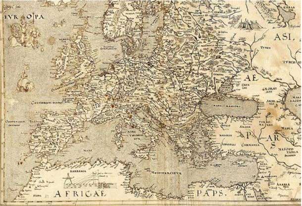
In a 1570 map of Europe, the island of Hy-Brasil is depicted in a different position (at the foot of the horse Europa is riding).
Although no maps today record Hy-Brasil as a real place, many mysteries surrounding it remain, which will likely continue to be debated for a long time.